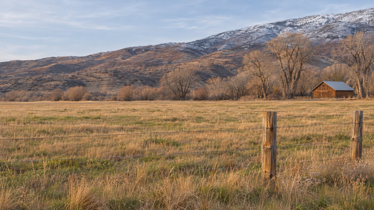
UDOT has a preferred route for the Heber Valley Corridor and a cost estimate above $760 million. It has no money set aside to design, buy land for or build the road. The final decision isn't expected until spring 2027. In October 2026, Wasatch County and Heber City adopted an agreement that decides what happens to the North Fields, the farmland the preferred route crosses. If you're comparing Heber Valley locations, the land around the bypass is now more certain than the bypass itself.
A Route With No Construction Budget
UDOT's project page was last revised Oct. 23, 2026. It says the Final Environmental Impact Statement and Record of Decision should come out in spring 2027 and that an updated project schedule is still being worked out. The Draft EIS came out on Jan. 7, 2026 and named Alternative B as the preferred route. Until the Record of Decision is signed, "preferred" is as far as it goes.
The money is further behind than the paperwork. UDOT's Draft EIS FAQ says no funding exists for final design, right-of-way acquisition or construction. Once a decision is signed, the project still has to compete for priority. State transportation funds are already committed through 2031, with a draft program covering 2032. In UDOT's words, "We are 6 years out at a minimum, likely more." The same FAQ says the Olympics bring no special funding, and that the project may be built in phases, though UDOT hasn't studied how it would split the work.
The Draft EIS put Alternative B at $760.5 million in 2025 dollars. In August, KPCW reported that UDOT had asked the state transportation commission for an extra $1 million. That money pays for wetland studies, design updates and traffic modeling. None of it is for construction. Project manager Craig Hancock told the Heber City Council why the extra work was needed:
"This additional work is needed, of course, to respond to all the comments we received from the community."
KPCW called the spring 2027 date the latest in a "yearslong series of delays." UDOT has been studying the route since 2020.
Where Alternative B Runs Today
The Draft EIS describes the preferred route in segments:
- North end. The route leaves US-40 at Potter Lane and College Way and crosses the North Fields on a new road to a connection at 900 North.
- Through the North Fields. This section would be four lanes with a 65-mph limit, a 50-foot median and a trail. It would pass over Potter Lane, 600 West, 1800 North and 1200 North with no intersections along the way.
- West side. A 65-mph corridor runs west of downtown from 900 North toward US-189, with an interchange at SR-113 and a connection at 1300 South in the sewer fields.
- At 1300 South. Through lanes would be elevated over 300 West, US-189 and Daniels Road. One-way frontage roads at ground level would meet Industrial Parkway with right-in, right-out access only.
UDOT calls the current alternatives freeway-type, limited-access roads. Drivers would get on and off only at interchanges or directional ramps. That shapes how individual neighborhoods would connect to the road. The FAQ says drivers on northbound Southfield Road couldn't turn directly onto the northbound corridor. Residents of Country Meadows would use 600 West to SR-113 to reach the interchange, about half a mile farther. UDOT is considering realigning Southfield Road to the high school intersection to fix that. UDOT also predicts less traffic on Mill Road under Alternative B.
For Alternative B, the Draft EIS estimates 328 acres of right-of-way and eight possible relocations of homes or businesses. Those numbers are projections. With no right-of-way funding, UDOT hasn't bought any of that land. A property can sit inside a drawn footprint for years without anything changing on the ground.
Two Places Where the Line May Move
The route isn't fixed even within Alternative B. UDOT's October update lists two shifts it's studying. One moves the 600 West section east within the North Fields, which would reduce the impact on farming but make some trips longer. The other moves the elevated 1300 South road farther south to reduce the impact on neighborhoods and rural character. UDOT says either change could affect traffic flow. It's also looking at adding bike and pedestrian crossings at the SR-113 interchange.
Those shifts came from public comment. UDOT received about 800 comments by the March 9, 2026 deadline, according to the Park Record. The Wasatch County Council's comment rejected Alternative B and asked UDOT to move it east, closer to US-40. Midway City Council backed that letter, and several Heber elected officials signed it as individuals, the Park Record reported. UDOT has said that once the analysis is done, it will judge the shifts with the same screening criteria it used earlier, and Alternative B stays preferred in the meantime.
For a buyer near 600 West in the north or near 1300 South in the south, that means the route on today's map is a draft. The version that counts will be published in the Final EIS.
The Fields Were Decided First
The route is still moving, but the land it crosses already has its future set. The Wasatch County Council unanimously approved a North Fields memorandum of understanding on Oct. 7. Under its terms, the North Fields stay outside Heber City's annexation boundary, and the county will zone the area only for rural agricultural homes. Heber City also commits preservation fees collected from the North Village to buying land and conservation easements north of the Potter Lane intersection. The Heber City Council approved it unanimously later that month, according to the Park Record, which made the agreement official.
Councilor Luke Searle summed it up for the Park Record: "Heber City will not annex. The county will not rezone." Both governments agree the protections should stay in place no matter which route UDOT picks. County Council Chair Erik Rowland called the MOU "just the beginning, not the end." A more binding interlocal agreement that includes Midway is still being negotiated.
The funding comes from development nearby. Heber City's North Village Overlay Zone covers about 95 acres at River Road and US-40. It was annexed in December 2024, and its development agreements cover The Crossings and The Slope. Developers there pay a one-time preservation fee of $2,500 per unit. Some land is already protected permanently. KPCW reported on March 20 that 60 acres of the Flying A Ranch now carry a conservation easement, and Utah Open Lands said more were in the works.
In April, the Park Record reported that the Heber City Council was most interested in preserving a slice of land between existing US-40 and the bypass route, north of 900 North and south of College Way. Councilor Aaron Cheatwood explained the reasoning: "If there's a brand new road, there's a lot of incentive to build something." Even before anyone knows exactly where the highway goes, the open land beside it has been committed to staying rural.
| As of November 2026 | Status |
|---|---|
| North Fields annexation boundary | Settled by MOU, county and city both approved |
| North Fields zoning | County limited to rural agricultural homes |
| Flying A Ranch, 60 acres | Under conservation easement since March 2026 |
| Interlocal agreement with Midway | In negotiation |
| Final bypass route | Expected in the Final EIS, spring 2027 |
| 600 West and 1300 South shifts | Under evaluation |
| Design, right-of-way and construction funding | None allocated |
Main Street Keeps Its Trucks for Now
All of this also matters downtown. Main Street is US-40 and part of the National Truck Network. Heber City Manager Matt Brower told KPCW that roughly 600 to 700 tanker trucks pass through downtown every day, and he hopes a finished bypass would take them elsewhere. In the same story, Brower and Rachel Kahler of the Community Alliance for Main Street talked about slower speeds, landscaped medians, crosswalks, bulb-outs, seating and a 25-mph limit. All of those are possibilities, not commitments.
Those ideas depend on a step outside the EIS. The Federal Highway Administration, not UDOT, would decide whether the new corridor becomes US-40. Handing Main Street over to the city, which would let it discourage trucks, isn't part of the current process. Heber City is gathering public input on a pedestrian-oriented "C Street" corridor downtown, but it hasn't chosen a final plan. If you're weighing a home near Main Street, count on today's truck traffic continuing at least as long as UDOT's six-year minimum.
What to Pull Up Before Writing an Offer Near the Corridor
- The alternatives map. UDOT's project site has interactive maps of both Draft EIS alternatives.
- Where the property sits relative to the two possible shifts. Pay particular attention to 600 West in the north and 1300 South in the south.
- The access pattern. Interchanges and ramps decide how a neighborhood reaches the corridor, as the Country Meadows and Southfield Road examples show.
- The noise analysis. UDOT links its Noise Technical Report and its general noise wall guidance from the project page.
- Whether the parcel is in the North Fields. If it is, the October MOU's zoning and annexation terms apply.
FAQ
When will the Heber bypass be built? UDOT hasn't set a construction date. Its FAQ says construction is at least six years away and likely longer, because no funding is allocated and state funds are committed through 2031.
Is Alternative B final? No. It's UDOT's preferred alternative. The route will be selected in the Final EIS and Record of Decision, expected in spring 2027.
Can the North Fields be developed if the bypass goes through? Under the October 2026 MOU, the fields stay out of Heber City's annexation boundary and county zoning is limited to rural agricultural homes. Both governments say those protections hold whichever route is chosen.
This post is general information, not legal, tax or financial advice. If you own or are considering a property near the proposed corridor, confirm your situation with an attorney or other qualified professional.
If you're looking at Heber Valley and want help reading a specific parcel against the UDOT maps and the North Fields agreements, the team at Peterson Calder can walk the property with you and go through the public documents together.